OpenAI Model Comparison: Image Location Analysis Performance
To determine the best model to use on the backend of whereisthisphoto.com, I analysed the performance of various OpenAI models at identifying photos taken all over the world.
The dataset was built from a combination of personal travel photos I have taken and photos downloaded from the r/whereintheworld subreddit. All photos had the metadata removed to ensure the models were solely performing image analysis on the photos.
The models were tested on the following criteria:
- Accuracy of country identification
- Average distance from the actual location
As well as a review of the results, I have included a detailed analysis of each image in the test dataset below, showing how different models performed in identifying their locations.
AI Model Performance Leaderboard
The chart below shows how each model performed across the test dataset. The score is derived from a combinatin of the country prediction accuracy and the average distance from the actual location.
| Rank | Model | Avg. Score | Country Accuracy | Avg. Distance | Price/M Tokens | Release Date |
|---|---|---|---|---|---|---|
| 1 | o3 | 97.64 | 94.59% | 27.3km | $10.00 | 16th April 2025 |
| 2 | gpt-4.1 | 95.40 | 94.59% | 49.3km | $2.00 | 14th April 2025 |
| 3 | o1 | 92.10 | 89.19% | 151.2km | $15.00 | 5th December 2024 |
| 4 | gpt-4o | 91.79 | 89.19% | 82.2km | $2.50 | 13th May 2024 |
| 5 | o4-mini | 86.09 | 78.38% | 164.7km | $1.10 | 16th April 2025 |
| 6 | gpt-4.1-mini | 82.29 | 81.08% | 639.5km | $0.40 | 14th April 2025 |
| 7 | gpt-4o-mini | 76.35 | 70.27% | 562.7km | $0.15 | 18th July 2024 |
| 8 | gpt-4.1-nano | 62.66 | 59.46% | 2569.5km | $0.10 | 14th April 2025 |
Country Prediction Rankings
| Rank | Model | Country Accuracy | Price/M Tokens | Release Date |
|---|---|---|---|---|
| 1 | o3 | 94.59% | $10.00 | 16th April 2025 |
| 1 | gpt-4.1 | 94.59% | $2.00 | 14th April 2025 |
| 3 | o1 | 89.19% | $15.00 | 5th December 2024 |
| 3 | gpt-4o | 89.19% | $2.50 | 13th May 2024 |
| 5 | gpt-4.1-mini | 81.08% | $0.40 | 14th April 2025 |
| 6 | o4-mini | 78.38% | $1.10 | 16th April 2025 |
| 7 | gpt-4o-mini | 70.27% | $0.15 | 18th July 2024 |
| 8 | gpt-4.1-nano | 59.46% | $0.10 | 14th April 2025 |
Coordinates Location Accuracy
| Rank | Model | Avg. Distance | Price/M Tokens | Release Date |
|---|---|---|---|---|
| 1 | o3 | 27.3km | $10.00 | 16th April 2025 |
| 2 | gpt-4.1 | 49.3km | $2.00 | 14th April 2025 |
| 3 | gpt-4o | 82.2km | $2.50 | 13th May 2024 |
| 4 | o1 | 151.2km | $15.00 | 5th December 2024 |
| 5 | o4-mini | 164.7km | $1.10 | 16th April 2025 |
| 6 | gpt-4o-mini | 562.7km | $0.15 | 18th July 2024 |
| 7 | gpt-4.1-mini | 639.5km | $0.40 | 14th April 2025 |
| 8 | gpt-4.1-nano | 2569.5km | $0.10 | 14th April 2025 |
Methodology
Our testing methodology incorporated:
- A diverse set of images from personal travels and the r/whereintheworld subreddit
- Evaluation based on distance in meters from the actual location and correct country identification
- Normalized scoring system where closer predictions received higher scores.
Key Findings
- o3, the most recently released model in our testing, performed the best overall, demonstrating OpenAI's continued improvement in image location analysis capabilities.
- o3 and gpt-4.1 achieved identical country prediction accuracy, but gpt-4.1 is significantly more cost-effective at $2 per million tokens compared to o3's $10 per million tokens.
- Among the mini models tested, o4-mini showed the strongest performance, suggesting promising potential for the upcoming full o4 model release.
Detailed Analysis by Image Type
Famous Landmarks
For well-known landmarks like the Eiffel Tower or Colosseum, most models performed exceptionally well, with accuracy often within 100 meters. Even smaller models could recognize these iconic structures with high confidence.
Urban Environments
In urban settings with distinctive architecture or signage, o3 and GPT-4.1 demonstrated remarkable precision, often identifying not just the city but the specific street or neighborhood.
Natural Landscapes
Natural landscapes proved more challenging, with accuracy varying widely. The most advanced models could often identify general regions correctly, but precision depended heavily on the distinctiveness of the landscape features.
Suburban Areas
Suburban locations presented a challenge for all models, with even the top performers sometimes struggling to provide precise locations. In these cases, country-level identification remained relatively accurate, but street-level precision was rare.
Conclusion
Our testing reveals impressive capabilities in today's AI models for location identification, with o3 coming out on top but closely folllowed by GPT-4.1. These results highlight the rapid advancement in multimodal AI understanding, combining visual recognition with geographic knowledge.
For users seeking the most accurate location identification, larger models still offer significant advantages over their smaller counterparts. However, the performance of mini models may be sufficient for many everyday use cases, especially when dealing with distinctive landmarks or locations.
As these models continue to evolve, we can expect even greater precision in image location identification, making tools like whereisthisphoto.com increasingly valuable for travelers, photographers, and curious minds alike.
Detailed Image Analysis
Below is a detailed analysis of each image in our test dataset, showing how different models performed in identifying their locations. Each image is displayed alongside the results from each model, including their prediction accuracy and distance from the actual location.

Chulilla. Spain
Coordinates: 39.6557851293197, -0.8925492484373408
| Model | Score | Distance | Country | Predicted Location | Coordinates |
|---|---|---|---|---|---|
| gpt-4o | 99.98 | 423m | ✓ | Chulilla Canyon. Valencia. Spain | 39.6522, -0.8942 |
| o1 | 99.96 | 792m | ✓ | Chulilla Canyon. Valencia. Spain | 39.66, -0.9 |
| o3 | 99.93 | 1.4km | ✓ | Turia River Canyon. Chulilla, Valencia. Spain | 39.645, -0.885 |
| gpt-4.1 | 99.61 | 7.8km | ✓ | Chulilla Gorge. Valencia. Spain | 39.6631, -0.9831 |
| o4-mini | 85.34 | 346.9km | ✓ | Congost de Mont-rebei. Catalonia. Spain | 42.44, 0.98 |
| gpt-4.1-mini | 0.01 | 8695.0km | ✗ | Chorros de Somoto Canyon. Madriz. Nicaragua | 13.36, -86.4 |
| gpt-4o-mini | 0.01 | 8998.6km | ✗ | Canñon de la Huasteca. Nuevo León. Mexico | 25.6102, -100.4695 |
| gpt-4.1-nano | 0.00 | 9336.5km | ✗ | Canyon de la Vieja. La Paz. Bolivia | -16.56, -68.15 |

MIT. Cambridge. Massachusetts. USA
Coordinates: 42.35826604462596, -71.09414676335707
| Model | Score | Distance | Country | Predicted Location | Coordinates |
|---|---|---|---|---|---|
| o3 | 100.00 | 19m | ✓ | Alchemist sculpture, MIT Campus, Cambridge. Massachusetts. USA | 42.3581, -71.0942 |
| o1 | 99.99 | 199m | ✓ | MIT campus. Cambridge. United States | 42.3595, -71.0959 |
| gpt-4.1 | 99.99 | 240m | ✓ | Alchemist sculpture. Massachusetts Institute of Technology (MIT), Cambridge, USA | 42.3598, -71.0921 |
| gpt-4o | 99.99 | 297m | ✓ | Alchemist Sculpture. MIT Campus. Cambridge, USA | 42.3598, -71.0912 |
| gpt-4.1-mini | 67.65 | 1041.4km | ✓ | James Sanborn Sculpture. University of Michigan. Ann Arbor. USA | 42.278, -83.7382 |
| gpt-4.1-nano | 33.46 | 401.7km | ✗ | Montreal. Montreal. Canada | 45.5017, -73.5673 |
| o4-mini | 25.03 | 691.9km | ✗ | Nomade. Robarts Library, Toronto. Canada | 43.6629, -79.3965 |
| gpt-4o-mini | 1.76 | 3344.5km | ✗ | University of Alberta. Edmonton. Canada | 53.5232, -113.5263 |

Tegallalang Rice Terraces. Bali. Indonesia
Coordinates: -8.434824382507692, 115.28077234054496
| Model | Score | Distance | Country | Predicted Location | Coordinates |
|---|---|---|---|---|---|
| o4-mini | 99.99 | 146m | ✓ | Tegalalang Rice Terraces. Ubud, Bali. Indonesia | -8.4342, 115.2796 |
| gpt-4.1 | 99.99 | 202m | ✓ | Tegallalang Rice Terraces. Ubud, Bali. Indonesia | -8.4353, 115.279 |
| gpt-4.1-mini | 99.99 | 228m | ✓ | Tegalalang Rice Terrace. Ubud. Bali, Indonesia | -8.4344, 115.2828 |
| gpt-4o | 99.99 | 283m | ✓ | Tegalalang Rice Terrace. Bali. Indonesia | -8.4325, 115.2797 |
| o1 | 99.98 | 308m | ✓ | Tegalalang Rice Terrace. Ubud. Indonesia | -8.434, 115.2781 |
| gpt-4.1-nano | 99.96 | 865m | ✓ | Tegalalang Rice Terraces. Ubud. Indonesia | -8.4324, 115.2733 |
| o3 | 99.91 | 1.9km | ✓ | Tegalalang Rice Terrace. Ubud, Bali. Indonesia | -8.4178, 115.2797 |
| gpt-4o-mini | 99.60 | 8.1km | ✓ | Tegalalang Rice Terraces. Bali. Indonesia | -8.5078, 115.278 |

Venice. Italy
Coordinates: 45.439096190614194, 12.318233780380542
| Model | Score | Distance | Country | Predicted Location | Coordinates |
|---|---|---|---|---|---|
| gpt-4o | 99.99 | 286m | ✓ | Narrow Canal. Venice. Italy | 45.4408, 12.3155 |
| gpt-4.1 | 99.99 | 286m | ✓ | Canal. Venice. Italy | 45.4408, 12.3155 |
| o3 | 99.99 | 286m | ✓ | Narrow canal. Venice. Italy | 45.4408, 12.3155 |
| gpt-4.1-mini | 99.97 | 665m | ✓ | Venice. Veneto. Italy | 45.4386, 12.3267 |
| gpt-4.1-nano | 99.95 | 1.0km | ✓ | Venice. Cannaregio. Italy | 45.4484, 12.3192 |
| o4-mini | 99.94 | 1.1km | ✓ | Venice. Cannaregio. Italy | 45.445, 12.3297 |
| gpt-4o-mini | 99.93 | 1.4km | ✓ | Venice. Veneto. Italy | 45.4372, 12.3355 |
| o1 | 99.93 | 1.4km | ✓ | Canal in Venice. Veneto. Italy | 45.4379, 12.3358 |

Sun World. Ba Na Hills. Vietnam
Coordinates: 16.026563277569952, 108.03299002482896
| Model | Score | Distance | Country | Predicted Location | Coordinates |
|---|---|---|---|---|---|
| gpt-4.1 | 99.77 | 4.7km | ✓ | Ba Na Hills French Village. Da Nang. Vietnam | 16.0031, 107.9964 |
| o4-mini | 99.76 | 4.8km | ✓ | French Village. Ba Na Hills. Vietnam | 15.9944, 108.0027 |
| o3 | 99.74 | 5.2km | ✓ | Sun World Ba Na Hills French Village. Da Nang. Vietnam | 15.996, 107.996 |
| gpt-4o | 99.74 | 5.2km | ✓ | Ba Na Hills. Da Nang. Vietnam | 15.9953, 107.9964 |
| gpt-4.1-mini | 99.73 | 5.4km | ✓ | Ba Na Hills. Da Nang. Vietnam | 15.9971, 107.9927 |
| o1 | 99.72 | 5.6km | ✓ | Sun World Ba Na Hills. Da Nang. Vietnam | 15.9998, 107.989 |
| gpt-4o-mini | 10.16 | 1593.9km | ✗ | Genting Highlands. Pahang. Malaysia | 3.1007, 101.6009 |
| gpt-4.1-nano | 0.00 | 9784.4km | ✗ | Fabuleux Château. Montmartre. France | 48.8867, 2.3423 |

Belchite. Spain
Coordinates: 41.305061126226, -0.7530548254839884
| Model | Score | Distance | Country | Predicted Location | Coordinates |
|---|---|---|---|---|---|
| gpt-4.1 | 99.99 | 219m | ✓ | Church of San Martín. Belchite. Spain | 41.3031, -0.7533 |
| gpt-4o | 99.98 | 475m | ✓ | Church of San Pedro. Belchite. Spain | 41.3011, -0.7509 |
| o3 | 99.97 | 569m | ✓ | Ruins of Church of San Martín de Tours. Belchite, Aragón. Spain | 41.3, -0.752 |
| o1 | 99.93 | 1.3km | ✓ | Church of San Agustín Ruins. Belchite. Spain | 41.2935, -0.7578 |
| o4-mini | 98.86 | 23.1km | ✓ | Church ruins of Belchite. Aragon. Spain | 41.1761, -0.5376 |
| gpt-4.1-mini | 0.00 | 9215.5km | ✗ | San Antonio de Padua Church Ruins. Parral. Mexico | 26.9369, -105.6522 |
| gpt-4.1-nano | 0.00 | 9290.4km | ✗ | Santa Maria del Monte. Urbina. Mexico | 19.2899, -99.1419 |
| gpt-4o-mini | 0.00 | 0m | ✗ | Ruins of a church. Unknown area. Unknown country | 0, 0 |

Svaneti. Georgia
Coordinates: 42.9023105425406, 42.76450838682767
| Model | Score | Distance | Country | Predicted Location | Coordinates |
|---|---|---|---|---|---|
| gpt-4.1 | 99.21 | 15.9km | ✓ | Svaneti Towers. Mestia. Georgia | 43.0426, 42.7286 |
| gpt-4o | 99.20 | 16.2km | ✓ | Mestia. Svaneti. Georgia | 43.0456, 42.7297 |
| o3 | 99.20 | 16.2km | ✓ | Mestia. Upper Svaneti. Georgia | 43.045, 42.725 |
| gpt-4.1-mini | 98.70 | 26.4km | ✓ | Ushguli. Svaneti. Georgia | 43.1365, 42.7078 |
| gpt-4.1-nano | 98.33 | 33.9km | ✓ | Khevsureti. Khevsureti. Georgia | 42.8167, 42.3667 |
| o4-mini | 97.27 | 56.1km | ✓ | Ushguli. Upper Svaneti. Georgia | 42.551, 43.2567 |
| gpt-4o-mini | 96.86 | 64.8km | ✓ | Ushguli. Svaneti. Georgia | 42.3483, 43.0102 |
| o1 | 2.10 | 3171.2km | ✗ | Eiffel Tower. Paris. France | 48.8584, 2.2945 |

Oeschinensee. Switzerland
Coordinates: 46.49875223471309, 7.725654668480212
| Model | Score | Distance | Country | Predicted Location | Coordinates |
|---|---|---|---|---|---|
| o3 | 100.00 | 80m | ✓ | Oeschinen Lake. Bernese Oberland. Switzerland | 46.4988, 7.7267 |
| gpt-4.1 | 100.00 | 88m | ✓ | Oeschinen Lake. Bernese Oberland. Switzerland | 46.4983, 7.7266 |
| gpt-4o | 100.00 | 88m | ✓ | Lake Oeschinen. Bernese Oberland. Switzerland | 46.4983, 7.7266 |
| o4-mini | 99.98 | 392m | ✓ | Oeschinensee. Kandersteg. Switzerland | 46.4953, 7.7267 |
| gpt-4.1-mini | 99.97 | 558m | ✓ | Oeschinensee Lake. Bernese Oberland. Switzerland | 46.4939, 7.7275 |
| o1 | 99.94 | 1.3km | ✓ | Lake Oeschinen. Kandersteg. Switzerland | 46.51, 7.73 |
| gpt-4.1-nano | 98.00 | 40.9km | ✓ | Swiss Alps. Bernese Oberland. Switzerland | 46.5814, 8.2453 |
| gpt-4o-mini | 96.23 | 78.3km | ✓ | Klein Glattalp. Uri. Switzerland | 46.705, 8.703 |
Chiesta di Ciagnano. Bologna. Italy
Coordinates: 44.169352999247195, 11.08675129501828
| Model | Score | Distance | Country | Predicted Location | Coordinates |
|---|---|---|---|---|---|
| o3 | 98.75 | 25.4km | ✓ | Apennine Mountains. Emilia-Romagna. Italy | 44, 11.3 |
| gpt-4.1 | 98.31 | 34.4km | ✓ | Appennine Mountains. Emilia-Romagna. Italy | 44.4667, 10.9667 |
| gpt-4o | 97.78 | 45.5km | ✓ | Appennine Mountains. Emilia-Romagna. Italy | 44.5, 10.75 |
| o4-mini | 97.33 | 54.9km | ✓ | Tuscan Hills. Tuscany. Italy | 43.7, 11.3 |
| o1 | 97.14 | 59.0km | ✓ | Tuscan-Emilian Apennines. Tuscany. Italy | 44.15, 10.35 |
| gpt-4o-mini | 96.53 | 71.8km | ✓ | Emilia-Romagna. Northern Italy | 44.7185, 10.6109 |
| gpt-4.1-mini | 96.41 | 74.5km | ✓ | Tuscan Hills. Tuscany. Italy | 43.5246, 11.3426 |
| gpt-4.1-nano | 0.00 | 9659.2km | ✗ | California. Central Valley. United States | 37.8, -119.5 |

Norrköping. Sweden
Coordinates: 58.58656793981692, 16.18442577657127
| Model | Score | Distance | Country | Predicted Location | Coordinates |
|---|---|---|---|---|---|
| o3 | 99.95 | 1.1km | ✓ | Industrilandskapet on Motala Ström. Norrköping. Sweden | 58.596, 16.183 |
| gpt-4.1 | 84.06 | 384.0km | ✓ | Malmö kanal. Malmö. Sweden | 55.6031, 13.0038 |
| gpt-4o-mini | 29.38 | 531.8km | ✗ | Tampere. Pirkanmaa. Finland | 61.4978, 23.7601 |
| gpt-4.1-mini | 26.81 | 623.4km | ✗ | Nidelva River. Trondheim. Norway | 63.4292, 10.3934 |
| o1 | 24.83 | 700.0km | ✗ | Landwehr Canal. Kreuzberg. Germany | 52.4961, 13.4226 |
| gpt-4o | 20.59 | 887.3km | ✗ | Uferstraße. Chemnitz. Germany | 50.8394, 12.9296 |
| gpt-4.1-nano | 0.02 | 7635.2km | ✗ | Seattle. South Lake Union. Washington, USA | 47.6265, -122.3371 |
| o4-mini | 0.00 | 0m | ✗ | NaN, NaN |

Mini Europa. Brussels. Belgium
Coordinates: 50.89399553339399, 4.338897825398249
| Model | Score | Distance | Country | Predicted Location | Coordinates |
|---|---|---|---|---|---|
| gpt-4o | 99.99 | 179m | ✓ | Mini-Europe. Brussels. Belgium | 50.8949, 4.341 |
| o3 | 99.99 | 185m | ✓ | Mini-Europe. Brussels. Belgium | 50.895, 4.341 |
| o1 | 99.99 | 185m | ✓ | Mini-Europe. Brussels. Belgium | 50.895, 4.341 |
| gpt-4.1 | 99.99 | 215m | ✓ | Miniature Houses of Parliament. Mini-Europe. Brussels. Belgium | 50.8949, 4.3416 |
| gpt-4o-mini | 99.97 | 628m | ✓ | Mini-Europe. Bruparck. Belgium | 50.8959, 4.3473 |
| gpt-4.1-mini | 99.74 | 5.2km | ✓ | Houses of Parliament Miniature. Mini-Europe. Brussels, Belgium | 50.8481, 4.3499 |
| o4-mini | 44.15 | 124.3km | ✗ | Madurodam miniature park. The Hague. Netherlands | 52.011, 4.285 |
| gpt-4.1-nano | 35.90 | 331.3km | ✗ | Miniature World. Acton. United Kingdom | 51.506, -0.301 |

Taman Desa Aman. Kuala Lumpur. Malaysia
Coordinates: 3.092984707126988, 101.73891126775418
| Model | Score | Distance | Country | Predicted Location | Coordinates |
|---|---|---|---|---|---|
| gpt-4o | 99.62 | 7.7km | ✓ | Kuala Lumpur. Federal Territory. Malaysia | 3.139, 101.6869 |
| gpt-4.1 | 99.62 | 7.7km | ✓ | Kuala Lumpur skyline. Kuala Lumpur. Malaysia | 3.139, 101.6869 |
| gpt-4.1-mini | 99.62 | 7.7km | ✓ | Kuala Lumpur. Kuala Lumpur City. Malaysia | 3.139, 101.6869 |
| o1 | 99.57 | 8.7km | ✓ | Kuala Lumpur Skyline. Kuala Lumpur. Malaysia | 3.1578, 101.695 |
| gpt-4o-mini | 99.53 | 9.4km | ✓ | Kuala Lumpur. Federal Territory of Kuala Lumpur. Malaysia | 3.1655, 101.6942 |
| gpt-4.1-nano | 36.75 | 307.9km | ✗ | Singapore. Downtown. Singapore | 1.2944, 103.852 |
| o4-mini | 3.93 | 2543.4km | ✗ | Zhujiang New Town. Tianhe District. China | 23.12, 113.324 |
| o3 | 0.00 | 0m | ✗ | NaN, NaN |

El Chaltén. Santa Cruz Province. Argentina
Coordinates: -49.32770508542701, -72.89370948939126
| Model | Score | Distance | Country | Predicted Location | Coordinates |
|---|---|---|---|---|---|
| o1 | 99.97 | 616m | ✓ | El Chaltén. Santa Cruz. Argentina | -49.33, -72.886 |
| gpt-4o | 99.97 | 684m | ✓ | El Chaltén. Santa Cruz. Argentina | -49.3315, -72.8863 |
| gpt-4.1 | 99.95 | 980m | ✓ | Río de las Vueltas Valley. El Chaltén, Patagonia. Argentina | -49.3333, -72.8833 |
| o4-mini | 99.94 | 1.2km | ✓ | Mirador de los Condores. El Chaltén, Santa Cruz. Argentina | -49.329, -72.878 |
| o3 | 99.49 | 10.2km | ✓ | Mirador Río de las Vueltas. Santa Cruz Province. Argentina | -49.25, -72.82 |
| gpt-4o-mini | 40.20 | 218.1km | ✗ | Torres del Paine. Magallanes. Chile | -51.25, -73.5 |
| gpt-4.1-mini | 25.21 | 684.6km | ✗ | Futaleufú River Valley. Patagonia. Chile | -43.247, -71.481 |
| gpt-4.1-nano | 0.02 | 7991.0km | ✗ | Fiordland. Southland. New Zealand | -44.9533, 168.4455 |

Munich. Germany
Coordinates: 48.14045743718532, 11.577947604604782
| Model | Score | Distance | Country | Predicted Location | Coordinates |
|---|---|---|---|---|---|
| gpt-4.1 | 99.98 | 386m | ✓ | New Town Hall (Neues Rathaus). Munich. Germany | 48.1374, 11.5755 |
| gpt-4.1-mini | 99.98 | 386m | ✓ | New Town Hall (Neues Rathaus). Munich. Germany | 48.1374, 11.5755 |
| o3 | 99.98 | 386m | ✓ | New Town Hall (Neues Rathaus). Marienplatz, Munich. Germany | 48.1374, 11.5755 |
| o4-mini | 99.98 | 386m | ✓ | Neues Rathaus. Marienplatz. Germany | 48.1374, 11.5755 |
| o1 | 99.98 | 396m | ✓ | New Town Hall. Munich. Germany | 48.1373, 11.5755 |
| gpt-4o | 99.98 | 405m | ✓ | New Town Hall. Munich. Germany | 48.1372, 11.5755 |
| gpt-4o-mini | 99.98 | 405m | ✓ | Munich. Bavaria. Germany | 48.1372, 11.5755 |
| gpt-4.1-nano | 95.71 | 89.7km | ✓ | Neuschwanstein Castle. Bavaria. Germany | 47.5576, 10.7498 |

al-Mughsail Beach. Salalah. Oman
Coordinates: 16.8790912762519, 53.776900095525384
| Model | Score | Distance | Country | Predicted Location | Coordinates |
|---|---|---|---|---|---|
| o3 | 99.86 | 2.9km | ✓ | Mughsail Beach. Dhofar Governorate. Oman | 16.88, 53.75 |
| gpt-4.1 | 99.75 | 4.9km | ✓ | Mughsail Beach. Dhofar. Oman | 16.8587, 53.7359 |
| gpt-4o | 99.72 | 5.7km | ✓ | Mughsayl Beach. Dhofar. Oman | 16.8606, 53.8269 |
| o1 | 99.46 | 10.8km | ✓ | Mughsayl Beach. Dhofar. Oman | 16.93, 53.69 |
| o4-mini | 98.40 | 32.6km | ✓ | Ras Madrakah Beach. Dhofar. Oman | 16.99, 54.06 |
| gpt-4.1-mini | 67.11 | 1072.2km | ✓ | Camel Beach. Musandam Peninsula. Oman | 26.2833, 56.25 |
| gpt-4o-mini | 18.15 | 1013.5km | ✗ | Ras al Khaimah. Ras al Khaimah. United Arab Emirates | 25.8007, 55.9661 |
| gpt-4.1-nano | 0.03 | 7325.2km | ✗ | Kuta Beach. Bali. Indonesia | -8.7129, 115.1699 |

Gediminas Hill. Vilnius. Lithuania
Coordinates: 54.686725355074465, 25.291947654368556
| Model | Score | Distance | Country | Predicted Location | Coordinates |
|---|---|---|---|---|---|
| o4-mini | 99.99 | 229m | ✓ | Gediminas Castle Tower. Vilnius Old Town. Lithuania | 54.6872, 25.2885 |
| o1 | 99.98 | 319m | ✓ | Gediminas Tower. Vilnius. Lithuania | 54.685, 25.288 |
| o3 | 99.98 | 372m | ✓ | Gediminas Hill overlook. Vilnius. Lithuania | 54.685, 25.287 |
| gpt-4o-mini | 99.96 | 792m | ✓ | Vilnius. Vilnius County. Lithuania | 54.6872, 25.2797 |
| gpt-4.1 | 99.96 | 792m | ✓ | Vilnius. Vilnius County. Lithuania | 54.6872, 25.2797 |
| gpt-4.1-mini | 99.96 | 792m | ✓ | Vilnius. Vilnius County. Lithuania | 54.6872, 25.2797 |
| gpt-4o | 99.96 | 792m | ✓ | Vilnius. Vilnius County. Lithuania | 54.6872, 25.2797 |
| gpt-4.1-nano | 99.93 | 1.3km | ✓ | Vilnius. Naujamiestis. Lithuania | 54.6767, 25.2814 |

Meggen. Switzerland
Coordinates: 47.04642129884924, 8.368384234323914
| Model | Score | Distance | Country | Predicted Location | Coordinates |
|---|---|---|---|---|---|
| o1 | 99.94 | 1.3km | ✓ | Meggenhorn Castle. Meggen. Switzerland | 47.0417, 8.3534 |
| o3 | 99.92 | 1.7km | ✓ | Schloss Meggenhorn. Meggen Lucerne. Switzerland | 47.037, 8.386 |
| o4-mini | 44.18 | 123.8km | ✗ | Villa del Balbianello. Lenno. Italy | 46.111, 9.245 |
| gpt-4.1 | 43.69 | 135.0km | ✗ | Villa Monastero Gardens. Varenna. Lake Como. Italy | 46.0102, 9.2861 |
| gpt-4.1-mini | 43.68 | 135.1km | ✗ | Villa del Balbianello. Lake Como. Italy | 45.9881, 9.2332 |
| gpt-4o | 43.67 | 135.3km | ✗ | Villa Monastero. Varenna. Italy | 46.0103, 9.2934 |
| gpt-4.1-nano | 43.61 | 136.8km | ✗ | Villa Carlotta. Tremezzo. Italy | 45.9803, 9.2594 |
| gpt-4o-mini | 43.57 | 137.7km | ✗ | Villa Carlotta. Tremezzina. Italy | 45.9591, 9.2286 |

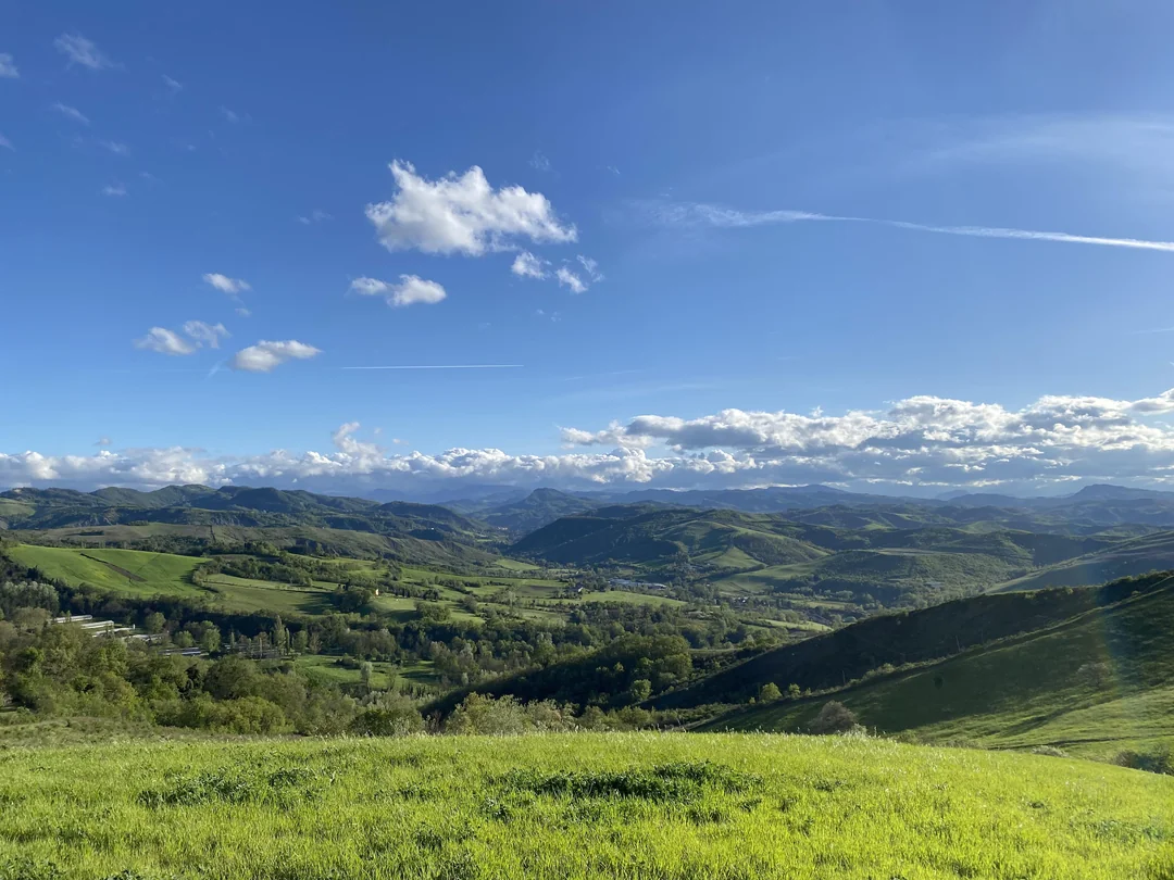
The Eastern Plains of Colorado
Coordinates: 40.81954371853186, -104.13637089434329
| Model | Score | Distance | Country | Predicted Location | Coordinates |
|---|---|---|---|---|---|
| o3 | 99.71 | 5.8km | ✓ | Pawnee National Grassland. Colorado Plains. United States | 40.85, -104.08 |
| gpt-4.1 | 90.12 | 220.0km | ✓ | High Plains. Eastern Wyoming. United States | 42.8, -104.2 |
| gpt-4o-mini | 83.27 | 407.3km | ✓ | Open Road. Prairie. Unknown | 39, -100 |
| gpt-4.1-nano | 80.79 | 484.8km | ✓ | Great Plains. Central North America | 39.8283, -98.5795 |
| o4-mini | 80.24 | 503.0km | ✓ | Great Plains Road. Kansas. USA | 38.5, -99.1 |
| gpt-4.1-mini | 79.65 | 522.4km | ✓ | Great Plains. Central United States. USA | 39, -98.5 |
| o1 | 75.07 | 690.2km | ✓ | Open Plains. Eastern Montana. USA | 47, -105 |
| gpt-4o | 19.07 | 963.7km | ✗ | Grasslands National Park. Saskatchewan. Canada | 49.1827, -107.3771 |

Lajes do Pico. Portugal
Coordinates: 38.40549841993781, -28.25315084428971
| Model | Score | Distance | Country | Predicted Location | Coordinates |
|---|---|---|---|---|---|
| o3 | 99.90 | 2.1km | ✓ | Pastures near Lajes do Pico. Pico Island. Azores, Portugal | 38.39, -28.24 |
| o1 | 99.55 | 9.0km | ✓ | Pico Island. Azores. Portugal | 38.46, -28.33 |
| gpt-4o | 98.95 | 21.3km | ✓ | Cais do Pico. Azores. Portugal | 38.5254, -28.4432 |
| gpt-4.1 | 98.92 | 21.9km | ✓ | Madalena. Pico Island. Azores. Portugal | 38.5351, -28.4419 |
| gpt-4.1-mini | 97.94 | 42.2km | ✓ | Faial Island. Azores. Portugal | 38.55, -28.7 |
| gpt-4o-mini | 95.01 | 105.1km | ✓ | Terceira. Azores. Portugal | 38.7169, -27.1149 |
| o4-mini | 89.42 | 237.7km | ✓ | Capelas. São Miguel Island. Portugal | 37.839, -25.639 |
| gpt-4.1-nano | 0.00 | 18032.2km | ✗ | Wellington. Island. New Zealand | -41.2866, 174.7762 |

Bari. Italy
Coordinates: 41.12775105014424, 16.872412154582783
| Model | Score | Distance | Country | Predicted Location | Coordinates |
|---|---|---|---|---|---|
| gpt-4o | 100.00 | 75m | ✓ | Bari Harbor. Bari. Italy | 41.1272, 16.8719 |
| o4-mini | 99.98 | 372m | ✓ | Porto di Bari. Apulia. Italy | 41.128, 16.868 |
| o3 | 99.97 | 625m | ✓ | Old Port. Bari. Italy | 41.1294, 16.8653 |
| gpt-4o-mini | 99.94 | 1.2km | ✓ | Bari. Apulia. Italy | 41.1171, 16.8719 |
| gpt-4.1-mini | 98.84 | 23.5km | ✓ | Harbor of Molfetta. Apulia. Italy | 41.1954, 16.6069 |
| gpt-4.1 | 98.81 | 24.2km | ✓ | Porto Vecchio. Molfetta. Apulia, Italy | 41.2008, 16.6013 |
| gpt-4.1-nano | 90.12 | 220.2km | ✓ | Marina. Mediterranean Coast. Italy | 40.6293, 14.3442 |
| o1 | 0.00 | 0m | ✗ | NaN, NaN |

National World war I museum and memorial. Kansas City. Missouri. USA
Coordinates: 39.08000875732042, -94.58630968477662
| Model | Score | Distance | Country | Predicted Location | Coordinates |
|---|---|---|---|---|---|
| o1 | 100.00 | 27m | ✓ | National World War I Museum and Memorial. Kansas City. United States | 39.08, -94.586 |
| gpt-4o | 99.99 | 168m | ✓ | Liberty Memorial. Kansas City, MO. USA | 39.0813, -94.5853 |
| gpt-4.1 | 99.99 | 219m | ✓ | National WWI Museum and Memorial. Kansas City. United States | 39.0817, -94.585 |
| o3 | 99.99 | 239m | ✓ | Liberty Memorial. Kansas City, Missouri. United States | 39.0819, -94.585 |
| o4-mini | 99.98 | 338m | ✓ | National World War I Museum and Memorial. Kansas City. USA | 39.0784, -94.583 |
| gpt-4o-mini | 99.98 | 449m | ✓ | Liberty Memorial. Kansas City. United States | 39.0833, -94.5833 |
| gpt-4.1-mini | 99.96 | 801m | ✓ | Liberty Memorial. Kansas City. USA | 39.084, -94.5786 |
| gpt-4.1-nano | 99.92 | 1.7km | ✓ | National World War I Museum and Memorial. Kansas City. USA | 39.0952, -94.586 |

Hoodoo trail near Fairmont Hot Springs
Coordinates: 50.32244020000868, -115.8859094
| Model | Score | Distance | Country | Predicted Location | Coordinates |
|---|---|---|---|---|---|
| o1 | 98.94 | 21.4km | ✓ | Lake Windermere. Invermere. Canada | 50.5, -116 |
| gpt-4.1 | 98.89 | 22.4km | ✓ | Windermere Lake. Columbia Valley. British Columbia, Canada | 50.5022, -116.0292 |
| o3 | 98.80 | 24.2km | ✓ | Invermere overlook. Columbia Valley. British Columbia, Canada | 50.52, -116.03 |
| gpt-4o | 98.29 | 34.7km | ✓ | Columbia Valley. British Columbia. Canada | 50.6205, -116.0306 |
| gpt-4.1-mini | 96.27 | 77.6km | ✓ | Lake Koocanusa. Kootenay Rockies. Canada | 49.65, -115.6 |
| gpt-4o-mini | 94.95 | 106.6km | ✓ | Kootenay Lake. British Columbia. Canada | 49.5931, -116.8487 |
| gpt-4.1-nano | 88.59 | 258.9km | ✓ | Okanagan Lake. Okanagan Valley. Canada | 50.0333, -119.4833 |
| o4-mini | 42.15 | 170.9km | ✗ | Lake Koocanusa. Lincoln County, Montana. USA | 48.8, -115.57 |
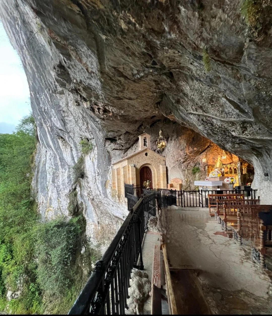
Holy Cave of Covadonga. Asturias. Spain
Coordinates: 43.30785743435334, -5.054537240405556
| Model | Score | Distance | Country | Predicted Location | Coordinates |
|---|---|---|---|---|---|
| gpt-4o | 99.99 | 106m | ✓ | Santa Cueva de Covadonga. Asturias. Spain | 43.3083, -5.0557 |
| o1 | 99.99 | 140m | ✓ | Santa Cueva de Covadonga. Cangas de Onis. Spain | 43.3066, -5.0547 |
| o3 | 99.97 | 618m | ✓ | Santa Cueva de Covadonga. Asturias. Spain | 43.305, -5.048 |
| gpt-4.1 | 99.96 | 838m | ✓ | Santa Cueva de Covadonga. Asturias. Spain | 43.3154, -5.0549 |
| o4-mini | 99.94 | 1.2km | ✓ | Santa Cueva. Covadonga. Spain | 43.3158, -5.0441 |
| gpt-4.1-mini | 99.93 | 1.3km | ✓ | Santuario de Covadonga. Asturias. Spain | 43.312, -5.07 |
| gpt-4.1-nano | 83.00 | 415.4km | ✓ | Chapel of St. Mary of the Mountain. Ordesa and Monte Perdido National Park. Spain | 42.617, -0.05 |
| gpt-4o-mini | 5.20 | 2263.5km | ✗ | Cave Monastery. Greece. | 39.575, 21.695 |

Eiffel Tower. Paris. France
Coordinates: 48.85829951251494, 2.2944276558201486
| Model | Score | Distance | Country | Predicted Location | Coordinates |
|---|---|---|---|---|---|
| gpt-4.1 | 100.00 | 12m | ✓ | Eiffel Tower. Paris. France | 48.8584, 2.2945 |
| gpt-4o-mini | 100.00 | 12m | ✓ | Eiffel Tower. Paris. France | 48.8584, 2.2945 |
| gpt-4o | 100.00 | 12m | ✓ | Eiffel Tower. Paris. France | 48.8584, 2.2945 |
| o3 | 100.00 | 12m | ✓ | Eiffel Tower. Paris. France | 48.8584, 2.2945 |
| o1 | 100.00 | 12m | ✓ | Eiffel Tower. Paris. France | 48.8584, 2.2945 |
| gpt-4.1-mini | 100.00 | 12m | ✓ | Eiffel Tower. Paris. France | 48.8584, 2.2945 |
| gpt-4.1-nano | 100.00 | 12m | ✓ | Eiffel Tower. Champ de Mars. France | 48.8584, 2.2945 |
| o4-mini | 0.00 | 0m | ✗ | NaN, NaN |

Buenos Aires. Argentina
Coordinates: -34.615776471031346, -58.36425925635625
| Model | Score | Distance | Country | Predicted Location | Coordinates |
|---|---|---|---|---|---|
| gpt-4.1-mini | 99.98 | 409m | ✓ | Fragata Sarmiento Museum Ship. Puerto Madero. Buenos Aires. Argentina | -34.6131, -58.3612 |
| o1 | 99.98 | 430m | ✓ | Puerto Madero. Buenos Aires. Argentina | -34.6119, -58.3643 |
| o4-mini | 99.97 | 698m | ✓ | ARA Presidente Sarmiento. Puerto Madero. Argentina | -34.6096, -58.3628 |
| gpt-4o-mini | 99.96 | 829m | ✓ | Puerto Madero. Buenos Aires. Argentina | -34.6083, -58.3643 |
| gpt-4o | 99.96 | 881m | ✓ | Fragata Sarmiento. Puerto Madero. Buenos Aires, Argentina | -34.6081, -58.3667 |
| o3 | 99.95 | 952m | ✓ | Fragata Presidente Sarmiento. Puerto Madero. Argentina | -34.6072, -58.364 |
| gpt-4.1 | 99.95 | 1.0km | ✓ | Fragata Sarmiento. Puerto Madero. Buenos Aires. Argentina | -34.6066, -58.3655 |
| gpt-4.1-nano | 0.00 | 11632.6km | ✗ | Melbourne. Docklands. Australia | -37.8204, 144.9444 |

Mt Baker. Washington. USA
Coordinates: 48.7765950825434, -121.81445076252866
| Model | Score | Distance | Country | Predicted Location | Coordinates |
|---|---|---|---|---|---|
| o4-mini | 100.00 | 4m | ✓ | Mount Baker. North Cascades. USA | 48.7766, -121.8144 |
| gpt-4.1 | 100.00 | 23m | ✓ | Mount Baker. North Cascades. Washington, USA | 48.7768, -121.8144 |
| o1 | 100.00 | 40m | ✓ | Mount Baker. North Cascades. United States | 48.7768, -121.814 |
| o3 | 100.00 | 74m | ✓ | Mount Baker. Washington State. United States | 48.776, -121.814 |
| gpt-4o | 99.99 | 101m | ✓ | Mount Baker. Washington. USA | 48.7775, -121.8144 |
| gpt-4o-mini | 99.98 | 327m | ✓ | Mount Baker, Washington, USA | 48.7766, -121.81 |
| gpt-4.1-mini | 90.37 | 214.0km | ✓ | Mount Rainier. Washington State. United States | 46.8523, -121.7603 |
| gpt-4.1-nano | 90.37 | 214.0km | ✓ | Mount Rainier. Cascade Range. Washington, USA | 46.8523, -121.7603 |

London. England. UK
Coordinates: 51.50600543826935, -0.1392421698142612
| Model | Score | Distance | Country | Predicted Location | Coordinates |
|---|---|---|---|---|---|
| o1 | 99.78 | 4.4km | ✓ | Tower Bridge. London. United Kingdom | 51.5055, -0.0754 |
| o3 | 99.78 | 4.4km | ✓ | Tower Bridge over the River Thames. London. United Kingdom | 51.5055, -0.0754 |
| gpt-4.1-nano | 99.78 | 4.4km | ✓ | London. City of London. United Kingdom | 51.5055, -0.0754 |
| o4-mini | 99.78 | 4.4km | ✓ | Tower Bridge. London. United Kingdom | 51.5055, -0.0754 |
| gpt-4.1 | 99.78 | 4.4km | ✓ | Tower Bridge. London. United Kingdom | 51.5055, -0.0754 |
| gpt-4o-mini | 99.78 | 4.4km | ✓ | London. Greater London. United Kingdom | 51.5055, -0.0754 |
| gpt-4o | 99.78 | 4.4km | ✓ | Tower Bridge. London. England | 51.5055, -0.0754 |
| gpt-4.1-mini | 99.78 | 4.4km | ✓ | London. Greater London. United Kingdom | 51.5055, -0.0754 |

Mdina. Malta
Coordinates: 35.885934757128176, 14.40323912422548
| Model | Score | Distance | Country | Predicted Location | Coordinates |
|---|---|---|---|---|---|
| gpt-4o | 100.00 | 21m | ✓ | Mdina. Malta. Malta | 35.8858, 14.4034 |
| gpt-4.1 | 100.00 | 61m | ✓ | Mdina Old Town. Mdina. Malta | 35.8854, 14.4031 |
| o3 | 99.99 | 106m | ✓ | St Paul's Cathedral alley. Mdina. Malta | 35.885, 14.403 |
| gpt-4.1-mini | 99.99 | 123m | ✓ | Mdina. Malta | 35.8869, 14.4039 |
| o1 | 99.99 | 137m | ✓ | St. Paul's Cathedral Alley. Mdina. Malta | 35.8869, 14.4023 |
| o4-mini | 99.99 | 264m | ✓ | St. Paul's Cathedral. Mdina. Malta | 35.8883, 14.4029 |
| gpt-4.1-nano | 99.49 | 10.2km | ✓ | Valletta. Strait of Malta. Malta | 35.8997, 14.5146 |
| gpt-4o-mini | 99.49 | 10.2km | ✓ | Valletta. Valletta. Malta | 35.8989, 14.5149 |

Cave Hill. Belfast. Northern Ireland
Coordinates: 54.649618590997214, -5.94539176648515
| Model | Score | Distance | Country | Predicted Location | Coordinates |
|---|---|---|---|---|---|
| o1 | 99.93 | 1.4km | ✓ | Cave Hill. Belfast. Northern Ireland | 54.64, -5.96 |
| gpt-4o | 99.92 | 1.5km | ✓ | Cave Hill. Belfast. Northern Ireland | 54.636, -5.9468 |
| o3 | 99.89 | 2.2km | ✓ | Cave Hill. Belfast. United Kingdom | 54.63, -5.95 |
| gpt-4.1 | 99.83 | 3.5km | ✓ | Belfast Lough. Belfast. Northern Ireland | 54.6386, -5.895 |
| gpt-4o-mini | 99.76 | 4.7km | ✓ | Belfast. Northern Ireland. United Kingdom | 54.6094, -5.9213 |
| o4-mini | 93.43 | 141.0km | ✓ | Howth Summit. Howth Head. Ireland | 53.385, -6.065 |
| gpt-4.1-nano | 43.33 | 143.1km | ✗ | Dublin Bay. Dublin. Ireland | 53.3712, -6.1773 |
| gpt-4.1-mini | 43.20 | 146.1km | ✗ | Dublin Bay. Dublin. Ireland | 53.3498, -6.2603 |

Adare Manor. Limerick. Ireland
Coordinates: 52.56418501151495, -8.777813172690523
| Model | Score | Distance | Country | Predicted Location | Coordinates |
|---|---|---|---|---|---|
| o1 | 99.98 | 336m | ✓ | Adare Manor. County Limerick. Ireland | 52.5612, -8.7771 |
| o3 | 99.97 | 698m | ✓ | Adare Manor. Adare, County Limerick. Ireland | 52.5643, -8.7881 |
| gpt-4o | 99.96 | 889m | ✓ | Adare Manor. Adare. Ireland | 52.5562, -8.7778 |
| gpt-4.1 | 99.94 | 1.2km | ✓ | Adare Manor. Adare. Ireland | 52.5616, -8.795 |
| gpt-4o-mini | 99.80 | 3.9km | ✓ | Adare Manor. Adare. Ireland | 52.5592, -8.7206 |
| gpt-4.1-mini | 99.64 | 7.2km | ✓ | Adare Manor Golf Course. County Limerick. Ireland | 52.5415, -8.6784 |
| o4-mini | 99.45 | 11.1km | ✓ | Adare Manor. Adare, County Limerick. Ireland | 52.5655, -8.6141 |
| gpt-4.1-nano | 91.27 | 191.8km | ✓ | Druid's Glen Golf Club. County Wicklow. Ireland | 53.1327, -6.0897 |

The Colosseum. Rome. Italy
Coordinates: 41.8912484494728, 12.493067747344234
| Model | Score | Distance | Country | Predicted Location | Coordinates |
|---|---|---|---|---|---|
| gpt-4o-mini | 99.99 | 133m | ✓ | Colosseum. Rome. Italy | 41.8902, 12.4923 |
| gpt-4o | 99.99 | 137m | ✓ | Colosseum. Rome. Italy | 41.8902, 12.4922 |
| gpt-4.1 | 99.99 | 137m | ✓ | Colosseum. Rome. Italy | 41.8902, 12.4922 |
| gpt-4.1-mini | 99.99 | 137m | ✓ | Colosseum. Rome. Italy | 41.8902, 12.4922 |
| gpt-4.1-nano | 99.99 | 137m | ✓ | Colosseum. Rome. Italy | 41.8902, 12.4922 |
| o3 | 99.99 | 137m | ✓ | Colosseum. Rome. Italy | 41.8902, 12.4922 |
| o4-mini | 99.99 | 137m | ✓ | Colosseum. Rome. Italy | 41.8902, 12.4922 |
| o1 | 99.99 | 137m | ✓ | Colosseum. Rome. Italy | 41.8902, 12.4922 |

Las Vegas. Nevada. USA
Coordinates: 36.112601428986395, -115.1728523510388
| Model | Score | Distance | Country | Predicted Location | Coordinates |
|---|---|---|---|---|---|
| o4-mini | 100.00 | 5m | ✓ | Paris Las Vegas. Las Vegas Strip. USA | 36.1126, -115.1728 |
| gpt-4o | 100.00 | 5m | ✓ | Paris Las Vegas Hotel. Las Vegas Strip. USA | 36.1126, -115.1728 |
| gpt-4.1 | 100.00 | 5m | ✓ | Paris Las Vegas Hotel & Casino. Las Vegas Strip. Las Vegas, USA | 36.1126, -115.1728 |
| gpt-4.1-mini | 100.00 | 5m | ✓ | Las Vegas Strip. Paradise. United States | 36.1126, -115.1728 |
| o3 | 100.00 | 12m | ✓ | Paris Las Vegas Hotel & Casino. Las Vegas Strip, Nevada. United States | 36.1127, -115.1728 |
| gpt-4o-mini | 100.00 | 40m | ✓ | Las Vegas Strip. Las Vegas. United States | 36.1126, -115.1733 |
| o1 | 99.99 | 212m | ✓ | Paris Las Vegas. The Strip, Las Vegas. USA | 36.1126, -115.1705 |
| gpt-4.1-nano | 99.99 | 233m | ✓ | Las Vegas Strip. Las Vegas. United States | 36.1147, -115.1728 |

Westgate Hotel. Las Vegas. Nevada. USA
Coordinates: 36.13565165124027, -115.15203658063234
| Model | Score | Distance | Country | Predicted Location | Coordinates |
|---|---|---|---|---|---|
| gpt-4o | 99.99 | 104m | ✓ | Elvis Statue. Westgate Las Vegas Resort & Casino. Las Vegas, USA | 36.1362, -115.1511 |
| gpt-4.1 | 99.99 | 155m | ✓ | Elvis Presley Statue. Westgate Las Vegas Resort & Casino. Las Vegas, USA | 36.1353, -115.1537 |
| o3 | 99.99 | 256m | ✓ | Elvis statue, Westgate Las Vegas Resort & Casino. Las Vegas. USA | 36.1351, -115.1548 |
| o1 | 99.97 | 600m | ✓ | Elvis statue. Westgate Las Vegas. United States | 36.141, -115.153 |
| o4-mini | 99.95 | 902m | ✓ | Elvis Statue. Westgate Las Vegas. United States | 36.1313, -115.1605 |
| gpt-4.1-nano | 99.85 | 3.0km | ✓ | The Plaza Hotel, Las Vegas Strip, Las Vegas, USA | 36.1147, -115.1728 |
| gpt-4.1-mini | 99.85 | 3.1km | ✓ | Elvis Presley Statue. International Hotel Lobby. Las Vegas, USA | 36.1126, -115.1711 |
| gpt-4o-mini | 99.81 | 3.8km | ✓ | The Flamingo. Las Vegas. United States | 36.1699, -115.1482 |

Science Museum. London. England. UK
Coordinates: 51.4972741286446, -0.1765169996531861
| Model | Score | Distance | Country | Predicted Location | Coordinates |
|---|---|---|---|---|---|
| gpt-4o-mini | 99.99 | 142m | ✓ | Science Museum. Kensington. United Kingdom | 51.4975, -0.1745 |
| gpt-4.1 | 99.99 | 152m | ✓ | Science Museum. London. United Kingdom | 51.4978, -0.1745 |
| gpt-4.1-mini | 99.99 | 152m | ✓ | Science Museum. London. United Kingdom | 51.4978, -0.1745 |
| o3 | 99.99 | 152m | ✓ | Science Museum. South Kensington. United Kingdom | 51.4978, -0.1745 |
| o4-mini | 99.99 | 152m | ✓ | Science Museum. South Kensington. United Kingdom | 51.4978, -0.1745 |
| gpt-4.1-nano | 99.96 | 720m | ✓ | London. South Kensington. United Kingdom | 51.491, -0.174 |
| gpt-4o | 99.76 | 4.7km | ✓ | Imperial War Museum. London. England | 51.4957, -0.1083 |
| o1 | 99.76 | 4.7km | ✓ | Imperial War Museum. Lambeth. England | 51.4963, -0.1082 |

Battersea Park. London. England. UK
Coordinates: 51.482147643481014, -0.1589871915465551
| Model | Score | Distance | Country | Predicted Location | Coordinates |
|---|---|---|---|---|---|
| o3 | 99.99 | 134m | ✓ | Peace Pagoda. Battersea Park, London. United Kingdom | 51.482, -0.1609 |
| gpt-4.1 | 99.98 | 451m | ✓ | Peace Pagoda. Battersea Park. London, United Kingdom | 51.4781, -0.1586 |
| gpt-4o | 99.98 | 462m | ✓ | Peace Pagoda. Battersea Park, London. United Kingdom | 51.478, -0.1588 |
| o1 | 99.97 | 591m | ✓ | Peace Pagoda. Battersea Park. United Kingdom | 51.478, -0.1643 |
| o4-mini | 99.97 | 623m | ✓ | Peace Pagoda. Battersea Park, London. United Kingdom | 51.4766, -0.1602 |
| gpt-4.1-mini | 99.96 | 882m | ✓ | London Peace Pagoda. Battersea Park. United Kingdom | 51.4743, -0.1608 |
| gpt-4.1-nano | 99.53 | 9.5km | ✓ | Kew Gardens. London. United Kingdom | 51.4779, -0.295 |
| gpt-4o-mini | 19.89 | 921.9km | ✗ | Pagoda. Munich. Germany | 48.1441, 11.5861 |

Newcastle. County Down. Northern Ireland
Coordinates: 54.21182727949207, -5.888130106736441
| Model | Score | Distance | Country | Predicted Location | Coordinates |
|---|---|---|---|---|---|
| o3 | 99.99 | 279m | ✓ | Newcastle Promenade. Newcastle, County Down. United Kingdom | 54.214, -5.886 |
| gpt-4o | 99.98 | 333m | ✓ | Newcastle Promenade. County Down. Northern Ireland | 54.2101, -5.8923 |
| gpt-4.1 | 99.98 | 483m | ✓ | Newcastle Promenade. County Down. Northern Ireland | 54.2152, -5.8928 |
| o1 | 99.97 | 592m | ✓ | Newcastle Promenade. County Down. Northern Ireland | 54.217, -5.886 |
| gpt-4o-mini | 99.92 | 1.5km | ✓ | Newcastle. County Down. Northern Ireland | 54.1986, -5.8944 |
| gpt-4.1-mini | 94.64 | 113.4km | ✓ | Bray Seafront. Bray. Ireland | 53.2018, -6.1116 |
| gpt-4.1-nano | 89.07 | 246.7km | ✓ | Oban. Oban Bay. United Kingdom | 56.4154, -5.4711 |
| o4-mini | 44.64 | 113.3km | ✓ | Bray Promenade. County Wicklow. Ireland | 53.202, -6.108 |

Għajn Tuffieħa. Malta
Coordinates: 35.928640649779815, 14.344122407757572
| Model | Score | Distance | Country | Predicted Location | Coordinates |
|---|---|---|---|---|---|
| o4-mini | 70.29 | 901.9km | ✗ | Kleftiko. Milos. Greece | 36.62, 24.35 |
| gpt-4.1-nano | 21.70 | 834.5km | ✗ | Cerretto Beach. Isola d'Elba. Italy | 42.7591, 10.2952 |
| o1 | 20.41 | 895.9km | ✗ | Kleftiko Caves. Milos Island. Greece | 36.6182, 24.2832 |
| o3 | 20.37 | 898.2km | ✗ | Kleftiko Caves. Milos. Greece | 36.631, 24.308 |
| gpt-4o | 20.33 | 899.9km | ✗ | Kleftiko Caves. Milos. Greece | 36.6178, 24.3281 |
| gpt-4o-mini | 20.14 | 909.6km | ✗ | Sarakiniko Beach. Milos. Greece | 36.7103, 24.4316 |
| gpt-4.1-mini | 20.05 | 913.9km | ✗ | Sarakiniko Beach. Milos. Greece | 36.7639, 24.4775 |
| gpt-4.1 | 19.86 | 923.6km | ✗ | Kleftiko Caves. Milos. Greece | 36.638, 24.5918 |